On a recent
Sunday morning I joined nine of my cycling friends on a flight from Oakland to
Seattle (Sea-Tac) where we met up with Fred our cycling guide from Black Sheep
Adventures for six days of cycling in the San Juan Islands. Fred had driven up from
Oakland in 'Dolly' his Sprinter van towing a trailer with our gear and bikes. We loaded up and headed to Anacortes, where we began our week by ordering large lunches at the Rockfish Grill (I had fish and chips - great way to start the week).

After lunch, and feeling appropriately stuffed, we rolled off to circumnavigate Fidalgo Island. The first few miles of my ride were a bit rough, as I nearly went down in
a busy intersection due to a bike malfunction, escaping with only a skinned knee. Then, a bit later on Salmon
Beach Rd, I was stung on my stomach by a bug that I never saw. It was a major sting as I felt it for a
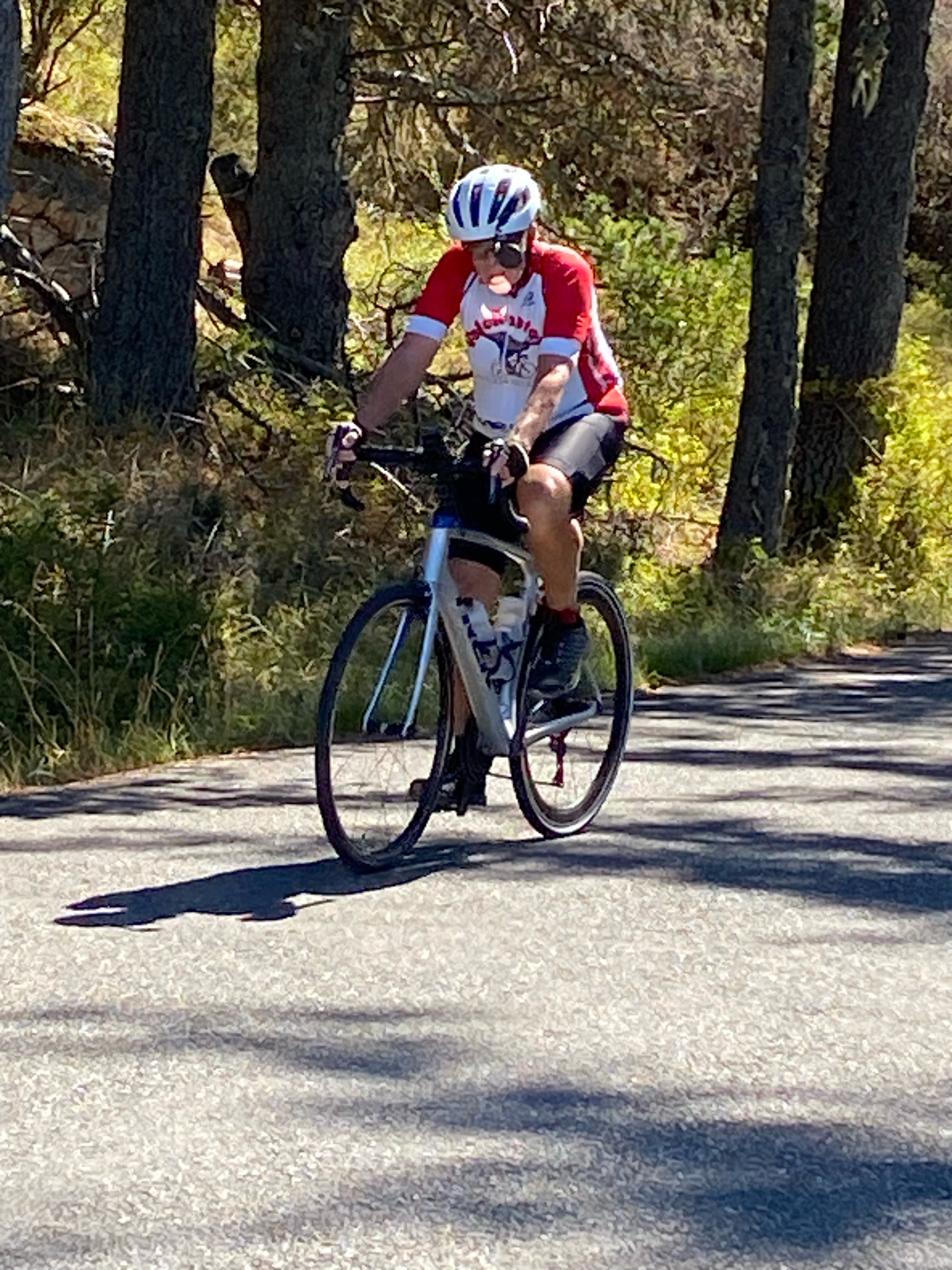
week. My little dramas aside, the cycling was ideal and Gail, Fred M., Sally and I stopped for a photo op. at one of the numerous overlooks.
We spent the first night at the very comfortable Majestic Hotel and enjoyed regaling our adventures of the day over dinner at Anthony’s At Cap Santa Maria restaurant.
Monday - Lopez Island
Our first full day started with a genuine cooked breakfast (included with
our rooms) at the Majestic, and I need to mention their bear claw. It was a bit small, but packed with scrumptiousness. In fact, in an unselfish action, I actually passed a few bites around. On the
way out I complimented the waitress on the bear claws, she asked if I wanted to
take one to go – and why not. She wrapped one up that I stashed and enjoyed the next morning.
After
breakfast, we took a short bike ride to the ferry terminal to catch the boat to our next stop, Lopez Island. Luckily,
with assistance from a very observant and helpful dock worker, we managed to
avoid getting on the Friday Harbor ferry (not our destination), and were
soon on our way to Lopez. We all made sure our bikes were secured for the trip.
Here is our Big Leader (Black Sheep Fred) herding some of his dwarf followers, and Sally and Chris enjoying the cruise.
Lopez Island is a delightful place to bike, with smooth, roads, minimal traffic, great views of forest, farmland, and small, deserted bays. The route around the island is 27 miles with 1800 ft of ascent, definitely enough to qualify as a workout.
The island is sparsely populated and there are few roads, so not wanting to miss a turn, I was on the lookout for road signs and thought a few of them unusual. The first one I really noticed was Hooterville Rd. Then a few miles later Bryn Mawr Ave, followed by Shark Reef and Namaste Lane.
Being a farm boy, I usually have to stop and look at the farm machinery of my youth whenever it is on display. Some of the tractors are even from before my time in the fields.
After admiring the tractors I cycled past Duck Walk Ln, Wild Goose Chase, and Rum Runner Rd. Lunch was in Lopez Village at the APIZZAPIE food truck. After devouring several pizzas we rode a couple more miles to the ferry dock, and arrived a bit early for our 3:40 ferry to Orcas Island. Now, 3:40 island time actually means whenever the boat arrives after 3:40. In this case, it was 2 hrs after. But the ferry dock didn’t lack for scenery and as we were replete from pizza, so No Problem. Martine and Sally found a nice spot to chat.
The ferry finally arrived, and we left the dock anticipating a short 20 minute cruise to Orcas Island. Pauline, Krish, Chris and I had front row seats as we crossed the channel,
But it soon became apparent that rather than approaching the opposite shore, we were going nowhere, stationary in the channel. It turns out we were still on island time. Long story short - our target dock on Orcas Island was occupied by another ferry that wasn’t leaving. This is the view we had for another 45minutes.

We did
eventually dock, and arrived at the very comfortable Outlook Inn in East Sound. Our only excitement there was the fire alarm that
went off around 9pm. Turns out someone
plugged too many ‘devices’ in their room, which triggered the alarm.
Tuesday-Wednesday Orcas Island
Tuesday
started with a short and scenic walk to breakfast. Gail took a moment to admire the wood sculpture along
the way.
The prime
early breakfast stop in East Sound is Olga Rising, a rustic cafe that doesn’t
look like much, but has fantastic food. The
line at the door starts forming 10 minutes before they open (8am) and all
seating is outside. I had the Olga Rising breakfast sandwich –
which the menu says is a 'Freshly Baked Buttermilk Biscuit with cheddar,
grilled sausage patty, arugula, a peppered egg served with a freshly made
freezer jam'. It was messy, but oh so tasty, the perfect balance of savory and sweet! It looked
something like this, with the addition of jam oozing out of all sides!
We needed a
good breakfast because this was the day for our Big Climb of the week. Namely, Mt.
Constitution, the literal high point of the trip (2350 ft). Now 2300 ft of
ascent is not an incredible amount of ascent if it is spread over 30 or 40
miles, but the top of Mt. Constitution is only 10 miles from our hotel at sea
level, and the first five miles of that were relatively flat.
Krish and I were having great fun toiling up the road as you can see😉. We all made it to the top and got the requisite VeloRaptor pictures.
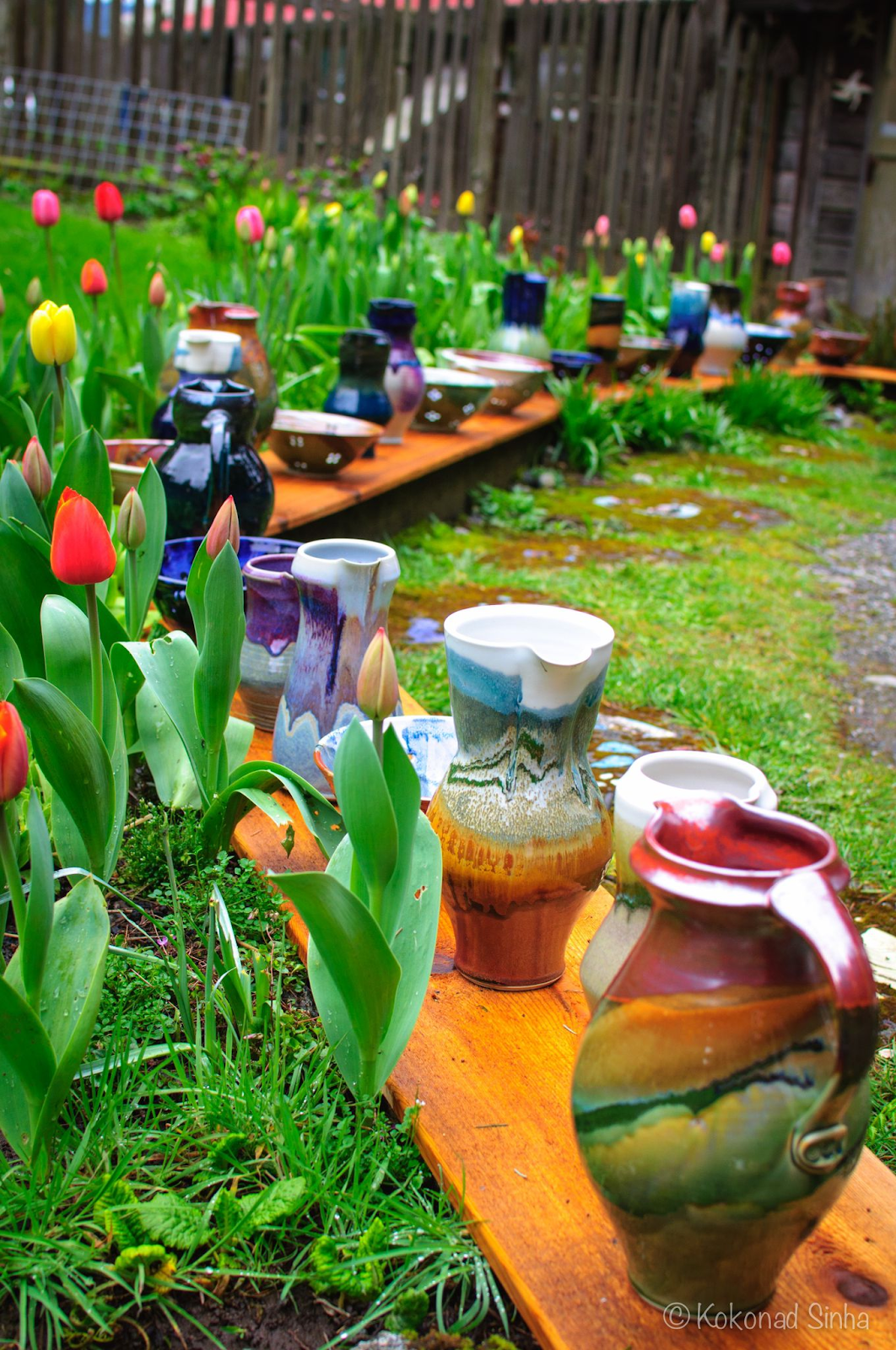
The descent down Mt. Constitution was fabulous and after a bit more biking we had a nice picnic lunch (with libations) at Cascade Lake, before heading back to East Sound. After a shower, a few of us paid a visit to Orcas Island Pottery studio and shop, which is located in an area of old growth cedars and Douglas fir.
Once back at the hotel, we took a short and very scenic walk to dinner. and we had a fun meal seated around a small table at Mijitas Mexican Kitchen. While I didn’t order a chile relleno I must say they looked great. They also make very good Margaritas although the first one I ordered fell victim to gravity and the convex, and very slick, table top. In fairness, our waitress did warn me of the danger, and to take care in placing my drink. Meanwhile, Krish
and Martine were anticipating their menu selections.
On our way
back to the hotel we were treated to some Mozart, courtesy of a local pianist.
Wednesday started with another Olga Rising breakfast sandwich and continued conversations
with folks we met the previous morning and on Mt Constitution! Our bike ride for the day was down the West
lobe of Orcas Island, East Sound to Deer Harbor. This is a beautiful 11 mile ride along
Crow Valley Rd. Note to cyclists, it does include a series of bumps (hills) with grades around 12%. I encountered
this friendly beast just standing around a pasture along the way.
At Deer Harbor we turned our bikes over to Fred and embarked
on a whale watching cruise with Deer Harbor Charters. Our captain was in touch with other whale watching boats and after about an hour of motoring we arrived at Orca central for that day. It
seems that Krish and Martine enjoyed the ride.
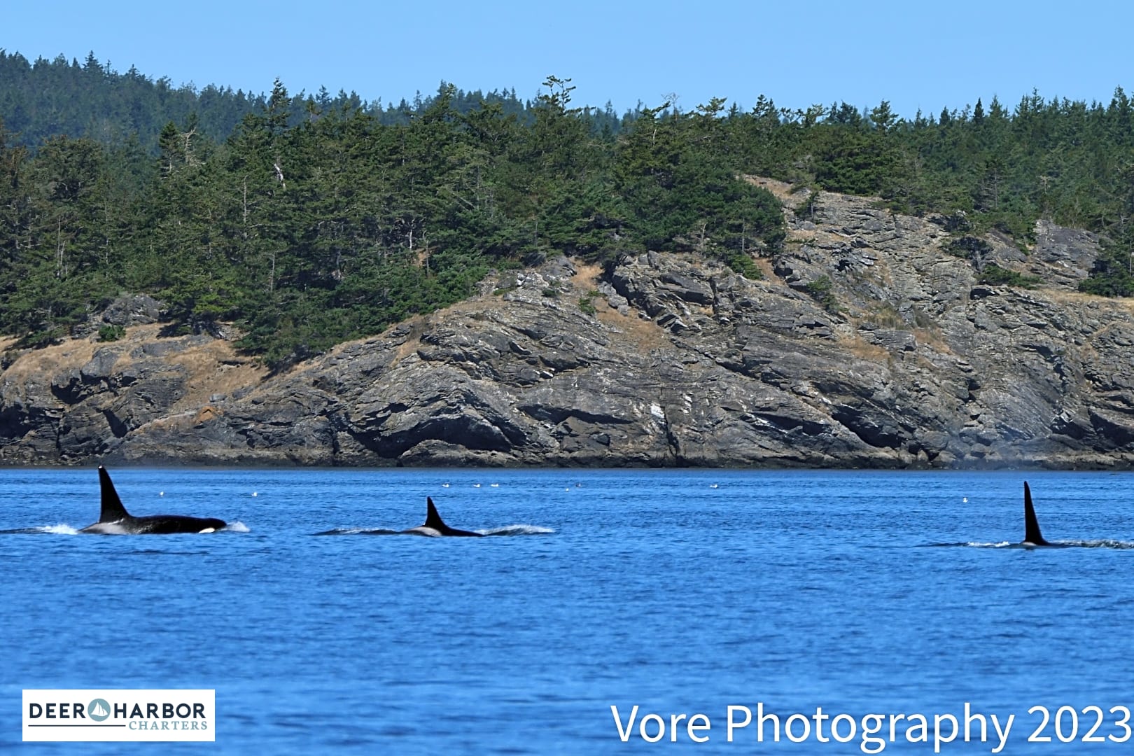
Mt Baker made its presence known, as did the orcas!
The Orcas gave us a good show for nearly an hour, then moved on. It was interesting to note that on the water, laws are enforced (unlike here in Oakland). Boats are required to stay 200 m from Orcas, and there were 5 or 6 boats along with ours more or less circling the Orcas at a distance. We had been watching for a while, when a small small cabin cruiser came along at speed and cut straight through the pod. To our surprise, and seemingly out of nowhere, a police boat appeared and chased him down! We were some distance away, but our captain figured the boater got a hefty fine. After the Orcas moved on, we headed to a couple of small islands to view some seals and eagles along our way to Friday Harbor.


That night at dinner we once again ran into folks we knew from our time on Orcas, and shared our
maritime adventures. After dinner a
few of us wanted ice cream and it turned out that the only ice cream in town
was at the county fair, happening a few blocks away. We walked the short distance to the fair ground, arriving at 7:55.
Turns out that admission was free after 8, so we hung out for 5 minutes enjoying
the vibe and then wandered in. We found the
ice cream and continuing to revisit my childhood, I had to admire the collection of old tractors
on display.
Thursday - San Juan
Island.
The adventure today a was a forty mile ride circling the island. Our first stop was the San Juan Islands Sculpture Park near Roche Harbor at the north end of the island. This is open to the public and covers about twenty acres.
After roaming the park for a bit, took a short walk over to Roce Harbor for
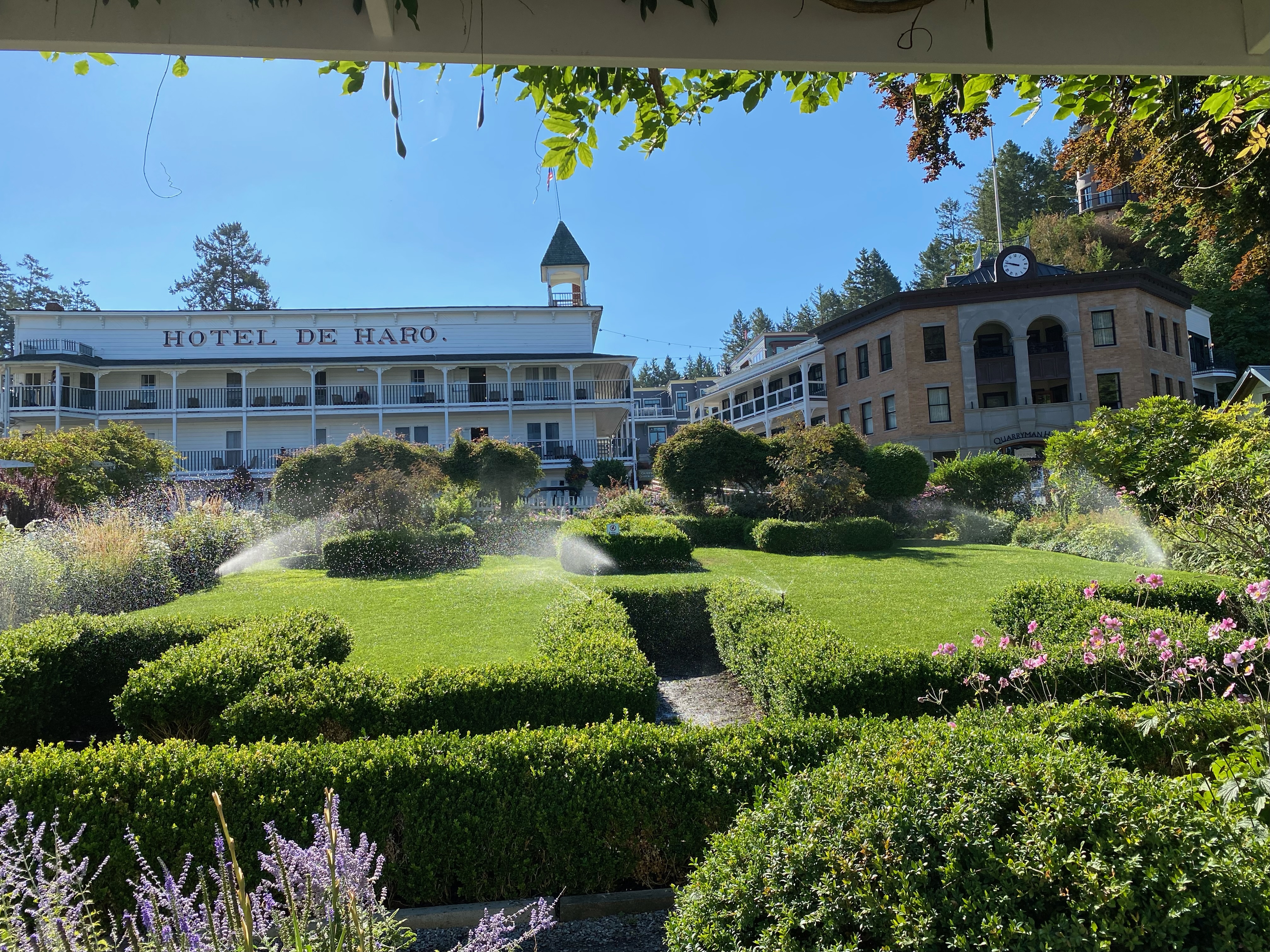
coffee and a donut. The Roche
Harbor website says it is a ‘world all its own’ and I have to agree. It is a tiny village with an historic hotel
named after Spanish explorer Gonzalo López de Haro. It is a small, rather posh village, and takes its history very seriously as one
can ‘watch the evening flag ceremony during the summer, complete with cannon
salute and U.S., British and Canadian national songs.’
Visit the
website https://www.visitsanjuans.com/roche-harbor-san-juan-island
for a nice description of this unique place.
After our
donut we pedaled south along the western side of the island to
Lime Kiln State Park where we found a lighthouse, some fabulous cliffs and a
bit of sea life.
Chris, Sally and
Gail fond it to be inspirational!
We continued
to the south end of the island for a picnic lunch at scenic Cattle Point in San
Juan Island National Historic Park.

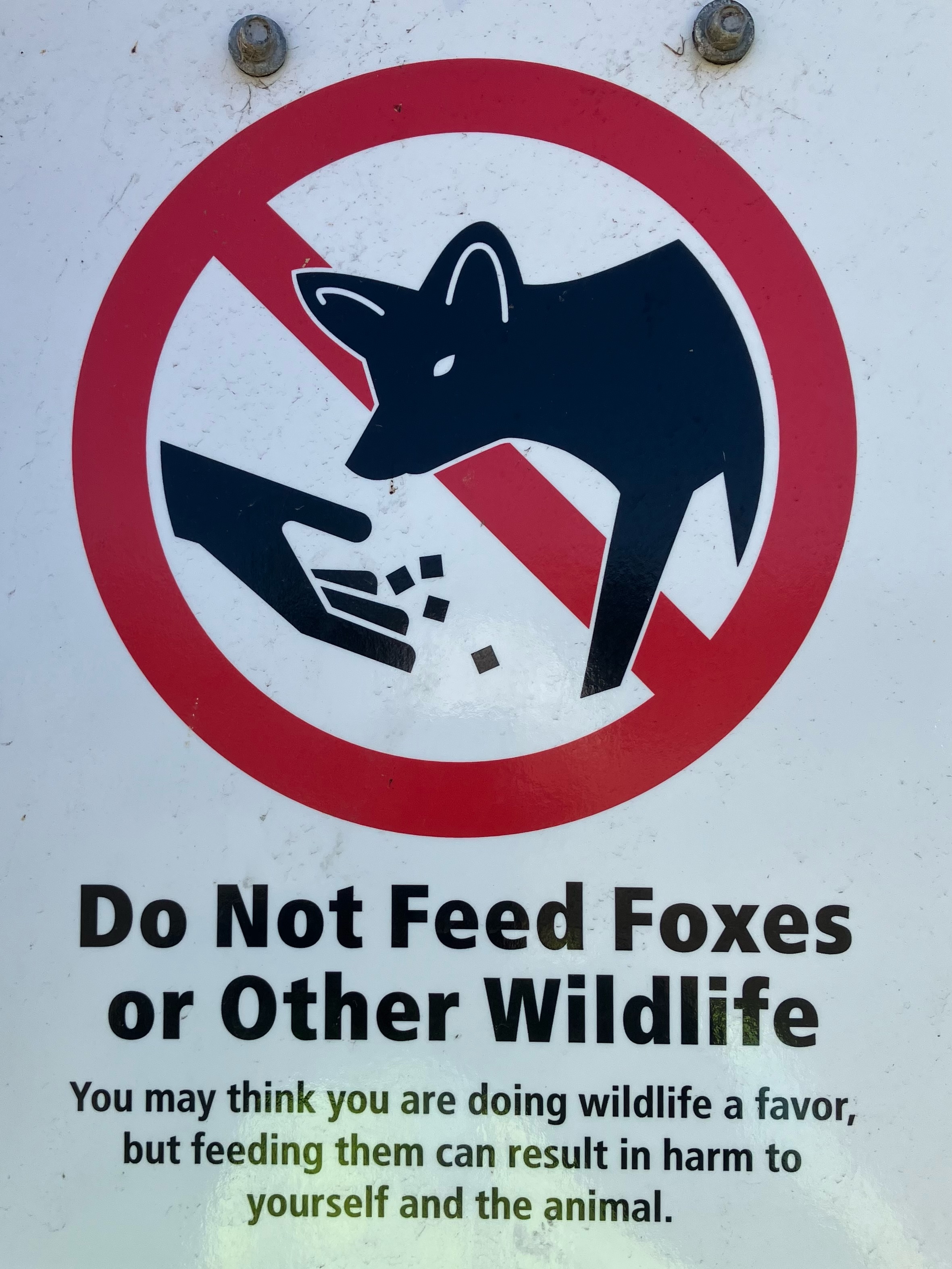
We did have one Fox in the crowd and managed to let her eat despite the local advisory .
.
Friday was our last day and we took an early morning ride, 16 miles out to the Pelindaba lavender farm. Pauline as usual was anxious to get wheels rolling and I mostly obliged.
Then after a shower and breakfast Fred got the van in line for the ferry, while Pauline found things a bit salty.
Our schedule allowed
time for a short visit to Pike Place Market. It was a beautiful day and the
market was packed. We braved the crowds and procured Blackened Salmon
Sandwiches from the Market Grill.
Chris
then led the way to Daily Dozen where she picked up a delicious dozen - figuring eating donuts was an appropriate way to finish the trip.